Sunday Things - Seattle LiDAR edition

posted in 3D by Cargo Cult on Sunday September 23 2012

What to do on long train journeys with no intertubes and no books to read? Instead of succumbing to tedious modern media consumption with a Kindle or iPad, why not break out the high-end modelling and rendering packages, combine them with geographical data conversion utilities and visualise some previously-downloaded LiDAR heightfield data of significant Pacific Northwestern cities?
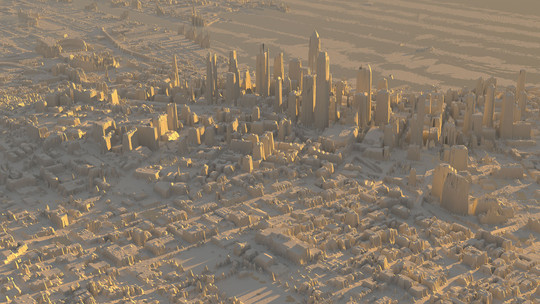
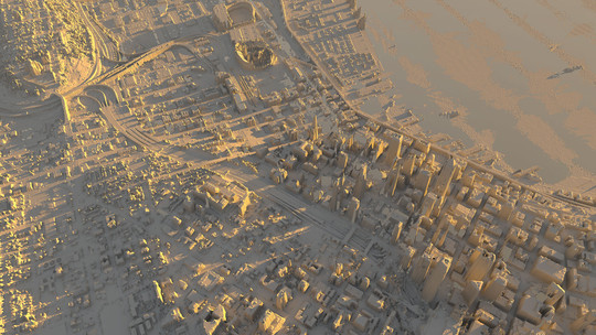
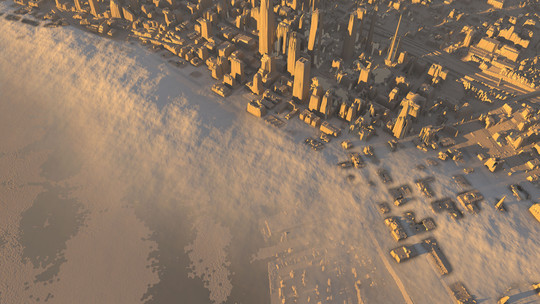
Seattle LiDAR 1 Seattle LiDAR 2 Seattle LiDAR 3 (this was supposed to be low-lying morning mist, but didn't turn out too well)
Rendering data from the Puget Sound Lidar Consortium, converted to GeoTIFF format with a recent GDAL installation, then rendered into glorious globally-illuminated worlds using one's own personal copy of Modo. Convert the funny ASCII .e00 files with something like 'gdal_translate -of gtiff -ot uint16 -scale 0 1000 0 65535 q47122e31ff.e00 q47122e31ff.tiff' - the resulting 16-bit TIFF can then be opened in Photoshop for checking and tweaking, then rendered as a displacement map in Modo. Surprisingly, it eats through my laptop's battery like you wouldn't believe.

Article comments (now closed)

SkUrRiEr's gravatar

1. Words cannot describe

Posted by SkUrRiEr at 7:04PM, Sunday September 23 2012

THE AWESOME!!!!!!!!

(Nice work, by the way)

It doesn't surprise me in the slightest that doing that would burn through the battery of your laptop.

Campaignjunkie's gravatar

2. Wicked witch

Posted by Campaignjunkie at 11:52AM, Friday October 5 2012

It's melting! Seattle is melting!

Article is now closed for commenting.